
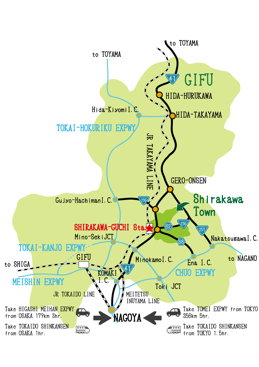
Access Map
The easiest way to access Shirakawa Town is by train. Visitors can also enjoy the beauty of the Hisui-kyo ravine as it changes throughout the seasons.
Trains
Tokyo(東京)/ Shin-Osaka(新大阪)- JR Tokai Shinkansen Nozomi(JR 東海道線 新幹線のぞみ)[100 min.]
- Nagoya(名古屋) - JR Tohkaido Line(JR 東海道本線)[20 min.]
- Gifu(岐阜) - JR Takayama Line(JR 高山線)[50 min.]
- Shirakawaguchi(白川口)
Nagoya(名古屋)
- Mei-Tetsu Inuyama Line(名鉄犬山線) [35 min.]
- Shin-Unuma(新鵜沼) - Walking[10 min.]
- Unuma(鵜沼) - JR Takayama Line(JR 高山線) [30 min.]
- Shirakawaguchi(白川口)
Toyama(富山)
- JR Takayama Line(JR 高山線) [90 min.]
- Takayama(高山) - JR Takayama Line(JR 高山線) [90 min.]
- Shirakawaguchi(白川口)
Tajimi(多治見)
- JR Taita Line(JR 太多線) [30 min.]
- Mino-Ohota(美濃太田) - JR Takayama Line(JR 高山線) [35 min.]
- Shirakawaguchi(白川口)
Cars
Nagoya(名古屋)- Route 41 [90 min.]
- Shirakawaguchi(白川口)
Chuo Expressway Ena IC(中央自動車道 恵那インター)
- The Ena Shirakawa route of prefectural road(県道恵那白川線) [45 min.]
- Shirakawaguchi(白川口)
Tokai-Kanjyo Expressway Minokamo IC(東海環状自動車道 美濃加茂インター)
- Route 41 [45 min.]
- Shirakawaguchi(白川口)
Tokyo(東京)/ Shin-Osaka(新大阪)
Please refer to driving map.(NEXCO Official site)
From Tokyo to Nagoya: 356km 5hr.
From Osaka to Nagoya: 179km 3hr.
Town Map
Shirakawa Town is part of the Tono area of Gifu, and its location is close to the centre of Japan.
Transportation
Nouhi Bus offers the service in following area.
Sami Line
Shirakawa Line
Kurokawa Line
Sohara Line
All Line